Trail On foot La Chapelle-en-Valgaudémar - Refuge de Vallonpierre - Photo
 Marco05
Marco05

User

© OpenStreetMap contributors
Length
Length
13.8 km
Max alt
Max alt
2278 m
Uphill gradient
Uphill gradient
801 m
Km-Effort
Km-Effort  
24 km
Min alt
Min alt
1547 m
Downhill gradient
Downhill gradient
801 m
Boucle
Boucle
Yes
Creation date :
2022-04-01 12:04:16.503
Updated on :
2022-12-15 13:26:23.475

(0 Reviews)

On foot
On foot
5h33
Difficulty : Difficult

Scan this QR Code to open this trail in the SityTrail application

FREE GPS app for hiking

Logo SityTrail SityTrail

IGN / Geographical institutes

Download SityTrail from the App Store Download SityTrail from Google Play

Logo SityTrail SityTrail World

The world is yours!

Download SityTrail from the App Store Download SityTrail from Google Play Download SityTrail on Huawei AppGallery

About

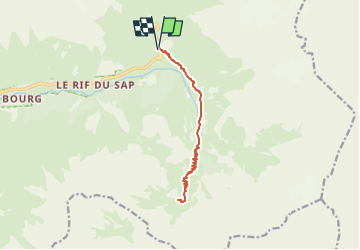
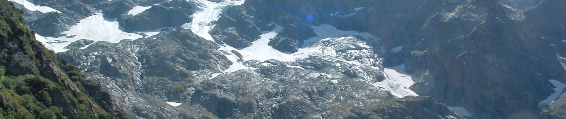
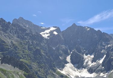
Trail On foot of 13.8 km to be discovered at Provence-Alpes-Côte d'Azur, Hautes-Alpes, La Chapelle-en-Valgaudémar. This trail is proposed by Marco05.

Description

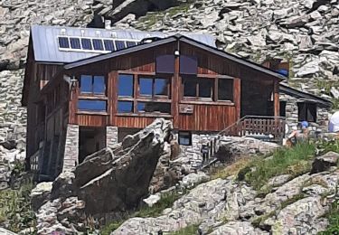
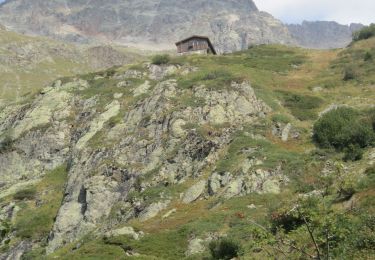
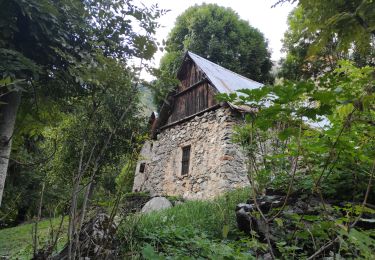
Même départ que pour le refuge de Chabournéou.
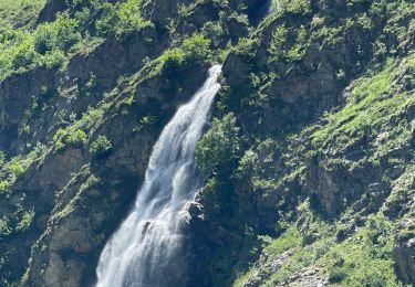
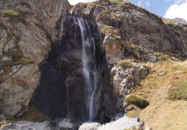
Deux kilomètres avant la fin de la vallée du Gioberney.
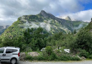
Le parking se situe en contrebas de la route sur la droite.
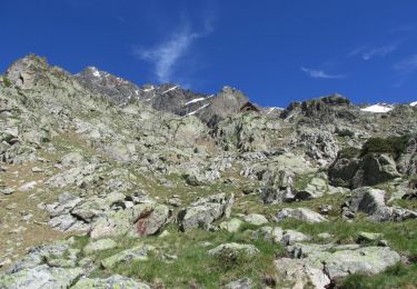
Final un pentu.

Elevation profile

Photos

Positioning

Country:
France
Region :
Provence-Alpes-Côte d'Azur
Department/Province :
Hautes-Alpes
Municipality :
La Chapelle-en-Valgaudémar
Location:
Unknown
Start:(UTM)
285200 ; 4968249 (32T) N.

Trails nearby

Trail Walking La Chapelle-en-Valgaudémar - Tour du Vieux Chaillol 2/5 - Du Gîte Le Casset au Refuge de Vallonpierre - Photo
Walking
tracegps

Walking

Medium
(1)
La Chapelle-en-Valgaudémar, Provence-Alpes-Côte d'Azur, Hautes-Alpes, France
11.8 km | 24 km-effort
4h 30min
No
Trail Walking La Chapelle-en-Valgaudémar - PARC NATIONAL DES ECRINS: REFUGE DU PIGEONNIER - Photo
Walking
djeepee74

Walking

Medium
La Chapelle-en-Valgaudémar, Provence-Alpes-Côte d'Azur, Hautes-Alpes, France
9.4 km | 21 km-effort
3h 22min
Yes
Trail On foot La Chapelle-en-Valgaudémar - Refuge du Pigeonnier - Photo
On foot
Marco05

On foot

Difficult
La Chapelle-en-Valgaudémar, Provence-Alpes-Côte d'Azur, Hautes-Alpes, France
7.8 km | 18.6 km-effort
4h 13min
Yes
Trail Walking La Chapelle-en-Valgaudémar - Refuge de Chalance - Photo
Walking
Marco05

Walking

Difficult
La Chapelle-en-Valgaudémar, Provence-Alpes-Côte d'Azur, Hautes-Alpes, France
7.5 km | 22 km-effort
5h 1min
Yes
Trail On foot La Chapelle-en-Valgaudémar - Refuge de Chabournéou - Photo
On foot
Marco05

On foot

Medium
La Chapelle-en-Valgaudémar, Provence-Alpes-Côte d'Azur, Hautes-Alpes, France
10.2 km | 17.1 km-effort
3h 53min
Yes
Trail Walking La Chapelle-en-Valgaudémar - Valgo 2 - J6 : refuge du Pigeonnier - Photo
Walking
ETMU5496

Walking

Difficult
La Chapelle-en-Valgaudémar, Provence-Alpes-Côte d'Azur, Hautes-Alpes, France
13.4 km | 27 km-effort
4h 15min
Yes
Trail Walking La Chapelle-en-Valgaudémar - Valgo 2 - J4 : refuge de Vallonpierre - Photo
Walking
ETMU5496

Walking

Difficult
La Chapelle-en-Valgaudémar, Provence-Alpes-Côte d'Azur, Hautes-Alpes, France
19 km | 35 km-effort
5h 31min
Yes
Trail Walking La Chapelle-en-Valgaudémar - Cabane du Près de l'Ours.Rif du Sap.06/09/20. - Photo
Walking
Dervalmarc

Walking

Easy
La Chapelle-en-Valgaudémar, Provence-Alpes-Côte d'Azur, Hautes-Alpes, France
5 km | 12.1 km-effort
1h 35min
Yes
Trail Walking La Chapelle-en-Valgaudémar - p - Photo
Walking
Dervalmarc

Walking

Medium
La Chapelle-en-Valgaudémar, Provence-Alpes-Côte d'Azur, Hautes-Alpes, France
7.3 km | 14.6 km-effort
3h 38min
Yes


Close
My subscriptions